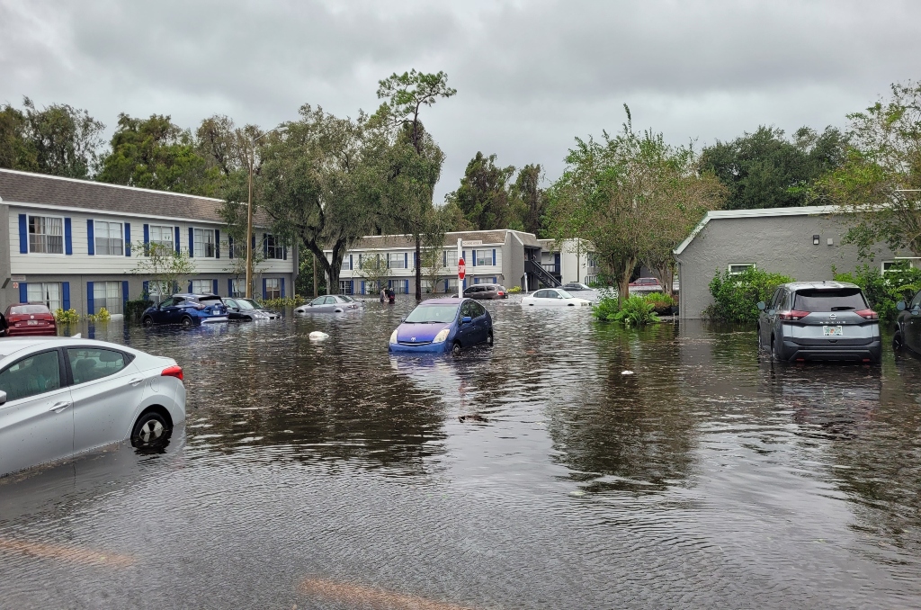
Flood Hurricane Ian in Central Florida — Courtesy: Shutterstock — america365
With rainy, erratic weather returning to the Sunshine State and increasing the likelihood of flash flooding and coastal flooding, it will be a nasty end to the week throughout Florida.
This is because of a cold front that is stationary along the Florida Straits and the arrival of a low-pressure system from the Gulf of Mexico, according to the FOX Forecast Center.
Together, they will enable bouts of intense precipitation and perhaps thunderstorms to saturate the area beginning on Wednesday and continuing well into the weekend.
Through the end of the workweek, there is a higher chance of flash flooding in some areas of South Florida, according to NOAA’s Weather Prediction Center.
The best odds of flash flooding from Miami through Fort Lauderdale and into the West Palm Beach region seem to be on Wednesday and Thursday.
Even if there is a decreased likelihood of flash flooding on Friday, residents in those areas still need to be vigilant for more flooding if the region continues to be soaked by heavy rains.
The arrival of the low-pressure system from the Gulf of Mexico on Saturday will put much of the Florida Peninsula at risk of flash floods.
Therefore, one must be vigilant not just in South Florida but also in Central Florida and northward toward the Florida–Georgia border.
This covers the entire Florida west coast, extending from Naples to Fort Myers, Tampa, and Cedar Key. On Saturday, there’s a flash flood risk in Port St. Lucie, Melbourne, Orlando, Daytona Beach, and Jacksonville on the East Coast.
In parts of southeast Florida where flash flooding is most expected, flood watches are now in place. The extent of these warnings may vary according to the amount of rain that falls in the upcoming days.
Increasing onshore easterly winds are predicted to cause dangerous surf, potentially fatal rip currents, coastal flooding, and substantial beach erosion to coastal communities through the end of the week, according to the National Weather Service office in Melbourne, Florida.
Due to enormous waves that are predicted to pound against the coast, high surf advisories have been issued along the entire Florida Atlantic coast, from the Florida-Georgia boundary to Fort Lauderdale.
Large waves in the 5–13 foot range are predicted for the surf zone in Volusia, Indian River, Saint Lucie, and Brevard counties starting on Wednesday night, according to the NWS in Melbourne.
In some areas of the eastern Florida Peninsula, waves of seven to ten feet are predicted.
Because of the approaching storm, the Sunshine State isn’t anticipated to live up to its moniker this week. Additionally, analysts predict several inches of rain by the beginning of the next week.
So, what will be the amount of precipitation in Florida? A great deal.
This week, between five and eight inches of rain are predicted for South Florida, which has already experienced its fair share of extreme weather, including a Flash Flood Emergency in Fort Lauderdale earlier this year.
Up to five inches of rain are predicted in other parts of the state; less flood rain is predicted south of Tampa.
In the western parts of the Florida Panhandle, high totals of rainfall are also predicted; along the Florida–Alabama state boundary, smaller totals are anticipated.
The FOX Forecast Center anticipates that the low-pressure system will start to move up the East Coast as it passes over the Florida Peninsula and enters the Atlantic Ocean.
For those who intend to travel early in advance of the holidays, that is not good news.
Inland areas of the mid-Atlantic and Northeast could get significant rainfall, strong winds, and possibly snowfall, according to the FOX Forecast Center.
We have some bad news, though, if you’re among the tens of millions of people who live along the Interstate 95 corridor and are hoping for snow so you may celebrate a white Christmas. It is anticipated that large cities such as Boston, New York City, Philadelphia, and Washington will experience just rain throughout this event.
And whether it’s raining or snowing, there will probably be an effect on traffic on the highways and at the main airports in our country.
Stories that matter are our priority. At Florida Insider, we make sure that the information we provide our readers is accurate, easy-to-read, and informative. Whether you are interested in business, education, government, history, sports, real estate, nature or travel: we have something for everyone. Follow along for the best stories in the Sunshine State.

Born and raised in South Florida, Krystal is a recent graduate from the University of Miami with professional writing experience at the collegiate and national news outlet levels. She’s a foodie who loves all things travel, the beach, & visiting new places throughout Florida.

